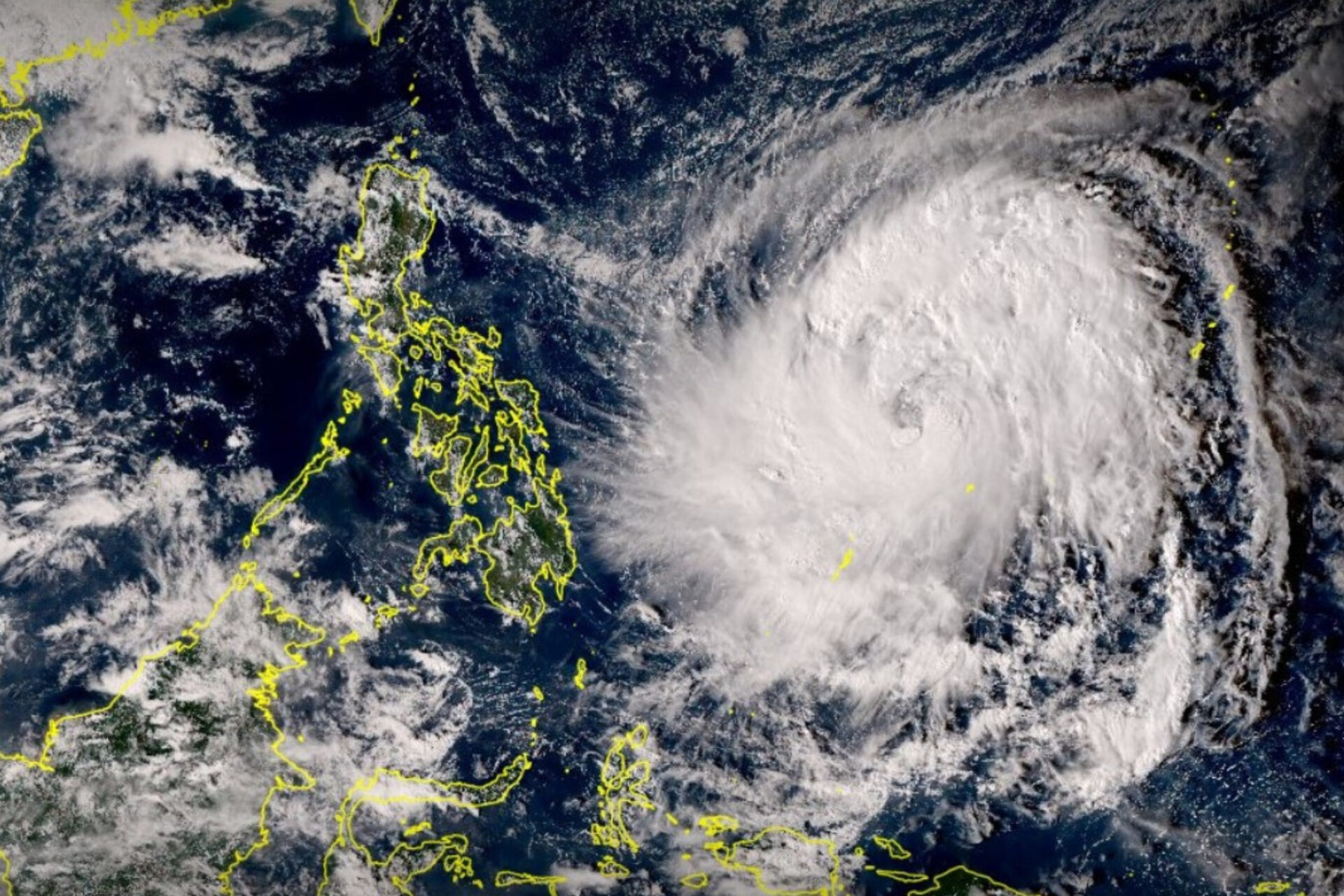
The eye of Typhoon Uwan (Fung-wong) entered the Philippine Area of Responsibility (PAR) on Friday night, intensifying into a typhoon with maximum sustained winds of 120 kph and gusts up to 150 kph, PAGASA reported.
The storm is moving west-northwest at 20 kph and is being closely monitored for possible landfall in eastern Luzon by Monday.
While most areas will have fair weather initially, heavy rains are expected in the Bicol Region from Saturday to Sunday, with red rainfall warnings issued for Camarines Sur, Albay, and Catanduanes.
Northern Luzon and parts of Central Luzon, including Aurora and Nueva Ecija, will face concentrated rains from Sunday to Monday, while Metro Manila and nearby provinces are under orange rainfall warnings.
PAGASA urged residents to monitor updates and prepare for possible impacts as the typhoon’s path may shift, potentially affecting other eastern and northern provinces.
Source: PhilNews24 | November 8, 2025
TYPHOON UWAN ENTERS PHILIPPINE AREA OF RESPONSIBILITY, WEATHER BUREAU SAYS


Latest from News
PhilHealth assured its members that coverage is available for heat-related illnesses such as heat stroke, dehydration,

The Philippines received 329,000 barrels of diesel from Malaysia as part of government efforts to secure

President Ferdinand R. Marcos Jr. has approved the official aviation insignia of the Philippine Army, formally

More taxpayers are filing and paying their annual income tax returns online as the April 15

The Department of Education (DepEd) has started nationwide orientation sessions to prepare schools for the shift